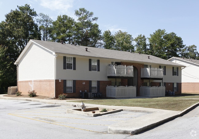
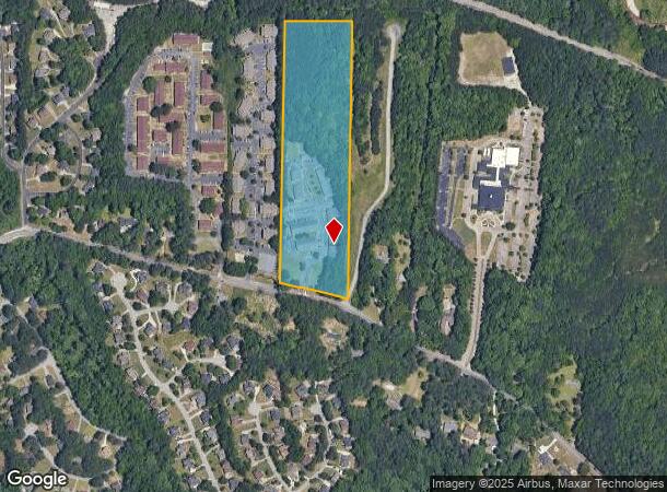
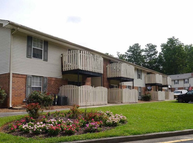
Property Record
4341 Cascade Rd Sw, Atlanta, GA 30331

NEARBY LISTINGS FOR SALE OR LEASE
-
-
View all Atlanta listings for sale on LoopNet.com
Property Detail
4341 Cascade Rd Sw
14F-0048-LL-068-7
0
Apartment
Fulton
X
Georgia
13121C0332F
48
2024
16.12 AC
2025
West Atlanta
007805
Atlanta
244,533 SF
Atlanta-Sandy Springs-Roswell, GA
DEMOGRAPHICS near 4341 Cascade Rd Sw
1 Mile
3 Mile
5 Mile
2024 Total Population
4,072
42,482
133,470
2029 Population
4,161
44,094
138,373
Pop Growth 2024-2029
+ 2.19%
+ 3.79%
+ 3.67%
Average Age
41
39
39
2024 Total Households
1,642
16,962
53,508
HH Growth 2024-2029
+ 2.25%
+ 3.82%
+ 3.75%
Median Household Inc
$51,303
$57,041
$53,091
Avg Household Size
2.40
2.50
2.40
2024 Avg HH Vehicles
2.00
2.00
1.00
Median Home Value
$298,199
$258,037
$253,627
Median Year Built
1983
1979
1979
Nearby Places
Map Layers
Map Styles
 Street
 Aerial
- Restaurants
- Banks
- Shops
- Fitness
- Groceries
PUBLIC TRANSPORTATION
AIRPORT
Hartsfield - Jackson Atlanta International
DRIVE
WALK
Distance
Hartsfield - Jackson Atlanta International
24 min
15.9 mi
Freight Ports
Georgia Ports - Savannah
DRIVE
WALK
Distance
Georgia Ports - Savannah
286 min
253.2 mi
SALE & LEASE HISTORY
LISTING DATE
SALE/LEASE

Jun 27, 2019
For Sale
Nearby Properties
Address
Land Use
TOTAL SIZE
Lot Size
Zoning
Address
Land Use
TOTAL SIZE
Lot Size
Zoning
Address
Land Use
TOTAL SIZE
Lot Size
Zoning
802,908 SF
18.26 AC
RG3
Address
Land Use
TOTAL SIZE
Lot Size
Zoning
830,966 SF
23 AC
MIXU
Address
Land Use
TOTAL SIZE
Lot Size
Zoning
6,603,740 SF
24.69 AC
RG3
Address
Land Use
TOTAL SIZE
Lot Size
Zoning
814,536 SF
37 AC
R3
Address
Land Use
TOTAL SIZE
Lot Size
Zoning
1,825,146 SF
16.16 AC
RG3
Address
Land Use
TOTAL SIZE
Lot Size
Zoning
395,218 SF
21.61 AC
A1
Address
Land Use
TOTAL SIZE
Lot Size
Zoning
729,946 SF
34.07 AC
M2
Address
Land Use
TOTAL SIZE
Lot Size
Zoning
70.35 AC
R3
Address
Land Use
TOTAL SIZE
Lot Size
Zoning
1,994,368 SF
17.10 AC
ACOND
Address
Land Use
TOTAL SIZE
Lot Size
Zoning
498,167 SF
11.18 AC
HI/WS
Address
Land Use
TOTAL SIZE
Lot Size
Zoning
1,333,625 SF
15.28 AC
A1
Address
Land Use
TOTAL SIZE
Lot Size
Zoning
77.30 AC
M2
Address
Land Use
TOTAL SIZE
Lot Size
Zoning
9,590,784 SF
27.23 AC
RG3
Address
Land Use
TOTAL SIZE
Lot Size
Zoning
339,382 SF
18.45 AC
HI
Address
Land Use
TOTAL SIZE
Lot Size
Zoning
1,715,322 SF
18.09 AC
A1
Address
Land Use
TOTAL SIZE
Lot Size
Zoning
680,087 SF
41.40 AC
M2
Address
Land Use
TOTAL SIZE
Lot Size
Zoning
725,612 SF
11.60 AC
A
Address
Land Use
TOTAL SIZE
Lot Size
Zoning
282,752 SF
12.68 AC
MIA
Address
Land Use
TOTAL SIZE
Lot Size
Zoning
113,293 SF
17.92 AC
M2
Address
Land Use
TOTAL SIZE
Lot Size
Zoning
903,588 SF
6.94 AC
RG3
Address
Land Use
TOTAL SIZE
Lot Size
Zoning
130,000 SF
4.28 AC
R4
Address
Land Use
TOTAL SIZE
Lot Size
Zoning
191,540 SF
7.74 AC
RG3
Address
Land Use
TOTAL SIZE
Lot Size
Zoning
327,308 SF
19.63 AC
MIA
Address
Land Use
TOTAL SIZE
Lot Size
Zoning
1,454,400 SF
14.81 AC
RG3
Address
Land Use
TOTAL SIZE
Lot Size
Zoning
312,000 SF
17.46 AC
LI-R
Address
Land Use
TOTAL SIZE
Lot Size
Zoning
236,556 SF
16.10 AC
LI
Address
Land Use
TOTAL SIZE
Lot Size
Zoning
176,026 SF
18.66 AC
HI
Address
Land Use
TOTAL SIZE
Lot Size
Zoning
274,920 SF
10.63 AC
M1A
Address
Land Use
TOTAL SIZE
Lot Size
Zoning
550,800 SF
34.65 AC
HI
The World's #1 Commercial Real Estate Marketplace
Connect with us
© 2025 CoStar Group
The information above has been obtained from sources believed reliable. While we do not doubt its accuracy we have not verified it and make no guarantee, warranty or representation about it. It is your responsibility to independently confirm its accuracy and completeness. Any projections, opinions, assumptions, or estimates used are for example only and do not represent the current or future performance of the property. The value of this transaction to you depends on tax and other factors which should be evaluated by your tax, financial, and legal advisors. You and your advisors should conduct a careful, independent investigation of the property to determine to your satisfaction the suitability of the property for your needs.